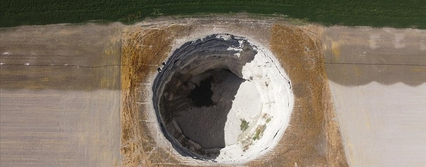
The Disaster and Emergency Management Presidency (AFAD) has announced that a "Sinkhole Sensitivity Map" will be produced, and a "Sinkhole Action Plan" will be prepared regarding the incidents that occurred in Konya.
According to the statement by AFAD, the project "Identification of Sinkhole Areas" carried out by the Konya Provincial Directorate of AFAD has reached its final stage.
As part of the project, the sinkhole formations occurring in the region will be classified, and their types will be modeled.
The significant role of structural geological elements, hydrogeological and meteorological conditions, as well as anthropological factors like excessive and uncontrolled groundwater usage, which play a role in sinkhole formation, will be identified within the scope of the project.
At the end of the study, changes indicative of sinkhole formation in the topography will be identified. Geological and geophysical analyses and measurements will be conducted in areas where sinkhole formation is likely, and their accuracy will be verified.
Using all this data, a mathematical model will be generated to create a "Sinkhole Sensitivity Map" for Konya. Subsequently, a Sinkhole Action Plan will be prepared.
Konya Governor Vahdettin Özkan stated, "One of the prioritized and high-risk parameters in the risk analysis concerning our city is sinkholes. Our scientists and industry experts are evaluating this together."